Monday, 17 February 2014

Walk 13 Marloes to Abereiddi 10th-14th February, 2014

So pleased that our collection tin, carried by Chris for all of our walks last year, had over £200 when we counted it over the break. Take a look at www.justgiving.com/Pamela-Mallpress for the current total...could do with sponsorship this year to reach my target...

Monday 10th February, 2014
After the wettest January since climate change began- not to mention a very soggy December too, and storms galore, we questioned our sanity as we set off yesterday...in snow flurries and passing flooded fields along the way. When we arrived at our lovely little house in Llanrhian however, the sun was shining. This morning we met the taxi man at Nolton Haven - just! We got a bit lost on our way there. He duly returned us to our last walk's end in Marloes ready for a short walk back down to the path at Musselwick sands. It was lovely to be back...if a bit muddy!
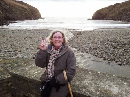
St Bride's Haven was the first of many Havens on our walk today and very pretty it was too. Here's Chris at the edge of the St Bride's Castle estate land. Now a holiday rental home...an upmarket one I believe.
The Bay has a pretty church and statutory lime kilns...a lot of them along the Pembrokeshire coast. And this Haven was a Mesolithic flint factory...hard to believe now.
The scenery was once more breathtaking and by now...the sky was blue and the sea was shimmering!
We passed the first of many waterfalls we were to see these few days as they disappeared over the cliffs near here, the spray flying back on us. As we approached the next Haven..Mill Haven, we found this sculpture on the cliff.
Apparently called Walking Eye and one of 5 by the same sculptor around here. The cliffs got higher and the geology so interesting as we wended our way past Stack Rocks and towards the next Havens..Little and Broad. As we rounded Ticklas Point, there they were.
We had superb views all around St Bride's Bay - seeing as far as Grassholm out in the Atlantic and nearer to us Skokholm and Skomer of our last walk's familiarity and then right round to the walk yet to come out to St David's Head and Ramsey Island. Today there were 7 ships sitting in the Bay waiting for their call into that bigger Haven at Milford! We dropped down into Little Haven through a wood - the only wood this week, we have passed through so many little - and big - woods now. The sun was glorious.
Little Haven is a lovely little village with its own Cobb.
Strange to think amongst all this prettiness that coal was mined here at the beginning of the last century! It was a steep climb out of Little Haven after lunch rest. In more normal tide days, we could have walked around the Settlands, the hill dividing Little and Broad Haven but today even though it was supposed to be low tide..it wasn't. Broad Haven is, as its name suggests, a much bigger settlement than Little Haven. Its beach, like all we were to see this time, was not the smooth white sands it usually is. All shook up by the storms. We didn't walk on the beach here as the clouds looked a bit glowering so we kept on walking up out of the little town. We soon went around another strange rock formation, Haroldston Chins, where the sandstone and limestone is layered with shale and softer rock so there is quite a lot of landslip. The skies lifted once more as the cliffs did! And the light was beautiful on the water as we looked back at the coast we had passed.
Soon we were going around Druidstone Haven which really is a pretty cove with a hotel and maybe 2 other residences. There did appear to be some kind of standing stone in a nearby field..was that the Druid Stone? As we climbed out of the Haven here, the views across the Bay were lovely.
The sky was lightening again and the sun shone between Martins Haven and Skokholm ...
as we approached our destination....Nolton Haven!
On the drive back, we passed through Roch. A little village with its own castle, unlike other Welsh castles we thought in its appearance.
Apparently it has had a few million spent on its refurbishment recently and is a holiday retreat for the rich and famous we understand. Anthony Hopkins was a recent visitor it seems. We quite liked our retreat in Llanrhian!

Tuesday 11th February
After a storm in the night, we awoke to grey skies but dry so off we set to meet the taxi at Porthclais, our destination for today's walk, and off he took us to Nolton Haven. The taxi driver had lost his dinghy to a January storm as it was swept away from the Porthclais harbour.
It was a gentle climb out of the Haven to be met with a lovely sky and super views out over the Bay.
The gentle start hadn't lasted, it was to be quite a roller coaster of cliffs today, in and out of coves. The gulls were much in evidence today, whereas yesterday we had seen starlings doing their swooping.
On the approach to Newgale sands, we passed a chimney stack, another witness to earlier coal mining days.
Seemed quite out of place when we gazed down at the lovely vista of the sands..
Newgale sands was an amazing sight. The local people are really upset that the sands are so strewn around after the storms. But we were really pleased to be able to see the ancient forest revealed. We were entranced looking at the ancient wood!


And not only the forest had been revealed, the storm had thrown up millions and millions of clams, razor clams, scallops - a sad sight really although we now understood what the gulls had been calling about!
It was so hard to believe that only last week a bus on the road at the other side of the great shingle bank had been tossed aside by a huge wave...
We had lost some time doing our beachcombing so off we set again up over the cliffs to look back on Newgale. It was a steep climb over Cwm Mawr, again we could have gone around it if the tide was as it should have been...but then it is February and we can't complain!
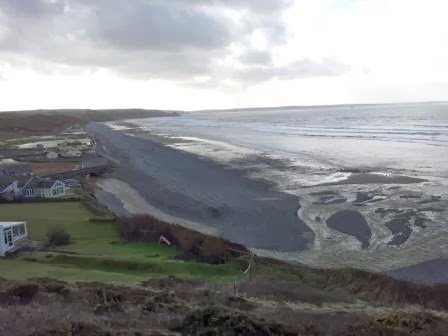
It was a terrific walk over the clifftops as we headed now for Solva with views ahead to St David's Head and Ramsey Island at the extreme left.
Climbing up out of one of the many coves, we saw Dinas Fawr headland...a truly magnificent sight..
Solva and the little bay immediately before it are linked by a hill called the Gribbin. The 2 bays were formed by glacial meltwater and their flat bottomed valleys are indeed testament to that. The Gribbin has an iron age settlement on top, not as clear to see as some have been. This is the first bay ahead of Solva with its pebble bank.
Solva is a pretty little harbour village. It again has lime kilns which was its main industry. Rain threatened as we went around the harbour front and climbed once more above the village...not easy whilst trying to eat one's sandwich! But the view back shows the twin valleys and the Gribbin clearly below.
Still quite a way to go as we headed now towards Caer Bwdy and Caerfai, close to St David's itself a little further inland, the smallest city in the UK. It seemed the map maker may have got her mileage wrong for today.....we passed another Iron Age fort and then a really clearly marked one just before we got to Caer Bwdy..hope you can make out the earthworks..
The Pembrokeshire path says it has 47 forts but we think it must be more surely. Wish we'd counted them now!
Caer Bwdy was another pretty little bay. The red sandstone had been quarried here to build the Cathedral at St David's.
Soon we came round to Caerfai Bay - here the Cambrian rock is the oldest in the UK at around 500 million 
years.
Thankfully most of the ups and downs were behind us now as we headed for St Non's Bay in the early evening! St Non was apparently St David's mother and St David was reputedly born on a stormy night on the cliffs here. The ruins of the original chapel are in a neighbouring field to the Chapel built in 1934 (on the left of the picture) in the grounds of a retreat overlooking the Bay.
Soon came round now to Porthclais - the original harbour for St David's with the sun now 
golden falling in the sky. 

Wednesday turned out to be as the forecasters had promised.......REALLY stormy. The wind just battered everything. Power cuts and all, not to mention thrashing rain in the morning especially. So taxi was cancelled and we just managed to stay upright for a brief walk around St David's..

Thursday 13th February
We arrived in Abereiddi this morning waiting for the taxi in some trepidation..not least because hail was falling! And a power cut meant we hadn't even had a cup of tea! The sacrifices made for doing this walk! We were duly returned to Porthclais (with its many lime kilns..) with the thought that we would get at least a few miles today...prepared to bail out if necessary...
So we were quite pleased when we got up on the cliffs to see that the sky was...could it be? ...breaking up? We were amazed as we gazed out to the sea and its increasing number of islands at the blue sky!
We soon came to our first Bay of the day at Porthlysgi. A very isolated bay and today much covered in flotsam and jetsam. There were several large buckets here that locals were obviously trying to use to get rid of the rubbish the sea has washed up....so many plastic bottles!
It was a marvellous walk up to St David's Head looking out to all the islands. There are so many little islands around Ramsey Island that they are just known collectively as the Bishops and Clerics. And I had great excitement when I spotted a chough! (I do have to admit that my photo wasn't this good as I didn't have my tripod with me...so I "borrowed" this picture...)
As we approached the end of the land, it was with a bit of a strange feeling. That we were indeed now leaving the south coast of Wales behind! We weren't exactly sure to be honest which headland really WAS the most Western point of Wales...
We enjoyed looking across to Ramsey Island with it s 2 hills Carn Ysgubor and Cader Rhwydog. Ramsey Sound does look quite foreboding with its heavy current and turbulation. I understand that in summer it is enjoyed by kayaks and jet skiers!
Very pretty walk around to St Justinian's which essentially is a lifeboat station...in a spectacular setting! There are also the ruins of St Justinian's Chapel.
St Justinian was a friend of St David's but was murdered on Ramsey Island reputedly. There were also some strange plants around here looking much like giant geraniums...It was then quite a gusty walk around the coast to Porthselau and its neighbouring and better known Whitesands Bay - or Porth Mawr.
A lovely sweep of sands with views out to the islands..and to St David's Head with the igneous intrusions of Carn Llidi and down to Carnberi and other "tors". It was a lovely walk out to St David's Head. So remote and wild here now and we were getting ever higher. At the end of the Head is another Iron Age fort - its entrance clearly defined..
..and just inside a dolmen, Coetan Arthur..
..soon followed by another one close by...
The landscape now was very rugged and remote and we were now quite high above the sea. 
The gusts had gone though so it was a really enjoyable walk, heading now to go over the shoulder of Penberi!
Once around Penberi, we had clear views of Strumble Head beyond but knew we wouldn't reach it this walk, as we had intended...nevertheless we had lots to enjoy. Another fort loomed but was inland so we couldn't get a clear sight of it but we did see Castell Coch, fallen into the sea ....Chris though thought it looked more like a sleeping dragon......
We had passed so many coves these last 3 days, it's just impossible to remember them all. As we approached Abereiddi, some of the coves had obviously once been quarried. Not sure what the tower on the headland was for - a landmark perhaps for vessels?
Abereiddi itself had been a large mining village until the 1920's when a storm hit the village and flooded the cottages - sound familiar? There ensued though a typhoid epidemic which effectively was the end of the working village. Now there only remain a few cottages.
The recent storms here have certainly decimated the popular place to park. The car park on the beach has simply been washed away - a phenomenal sight. And so our walk ended....Friday was another stormy day so we headed for our hills....the walk to Strumble has to wait til next time....

Monday, 30 December 2013

Happy Christmas and here's to a good 2014!

Hello everyone! Hope you all had a lovely Christmas and that most of you avoided the floods and power failures...and to those who didn't escape, hope you have a good 2014! We are missing our walks by the sea but planning is going ahead. I had a lovely book for Christmas about the coastal walk with lovely pictures...although I do think some of mine aren't bad!
In Wales we had a white Christmas - an icing sugar covering on Christmas Day. Luckily it didn't stay very long! And we have been trying to keep fit with some good walks in the Radnor Forest. Here was the Whimble view yesterday...
Not sure when the next walk will be exactly yet but we plan to have 18 more - 3 of which will be 5 day events. You can guess our holidays next year! Can't wait.

Great news to report is that with the help of Nigel, our friendly landlord in the Radnor Arms, probably the greatest pub in the world, we counted the money from the collection tin which Chris has manfully carried for 328 miles now. And....the total amount in there was £208.30!!!!

I have already "declared" £98.70 of this on the justgiving page as offline donations from those who have given me their donation so that means there was another £109.60 from people who contributed over the walks. So pleased and thank you all so much for your support. I know Velindre are very grateful too and I am just happy to try to help them.

Take care everyone and have a good New Year celebration and here's to a happy, healthy, peaceful 2014 for you all!

Monday, 18 November 2013

Walk 12 Pembroke to Marloes 13th-15th November, 2013

Well this was now definitely the last walk of the year...sad to say, but the snow may be coming in now! As in a quote Chris found today....."there is a fine line between hobby and mental illness"! I will begin though with giving the fundraising site as a reminder of why we are doing this....www.justgiving.com/Pamela-Mallpress
I know it has been a busy giving time with Children in Need and now the awful disaster in the Phillipines, there is so much we all would like to help with.

So we set off in the dark and minus temperature last Wednesday morning, arriving in Milford Haven at our chosen hotel, the Belhaven House, by 8.30 where we were picked up by the Call a Cab taxi and returned to Pembroke Castle, scene of our last completed walk!
It was by now a lovely morning and off we set with lovely views all around the mighty Pembroke castle. We followed the north of the Pembroke river through fields and then on a road into Pembroke Quay - quicker to write than to achieve! This part of the Pembrokeshire coastal path - from Angle to Sandy Haven past South Hook which we won't pass til tomorrow - is one that apparently lots of people miss out when walking the Pembrokeshire Coastal Path because of its industrialisation. But really they are missing out so much! There is so much to see. Pembroke Dock is full of information. The Dock really sprang up in the early 1800's to house the Navy and defend us from the French! We passed one of its Martello Towers close to Front Street - the first street to be built in the town to house the dockworkers.
On the wall next to the tower are plaques commemoratuing the history of the town, from its beginnings through to the Second World War when many bombs were aimed here and a Wellington crashed into the sea further downstream on its way home. Having had a good look around and enjoyed a coffee at K's Cafe, we set off to the Cleddau Bridge to cross the Abergleddau estuary. There is a further walk going further around the Haven, another 12 miles, which will wait for another time. It isn't part of the official coastal path.
The bridge was opened in 1976 (or thereabouts...) and is now the second bridge we've crossed so far, the first being on the A48 to Swansea - we're more used to going under them! But the view was terrific..At the other side of the bridge was the berth where HMS Warrior used to be moored.
We soon dropped down to the estuary side again and on losing the direction of the path at one point, we came across Brunel Quay just as we were entering Neyland. It was amazing to find that Brunel really created Neyland intending it to be the main dock for transatlantic ships. There had been a hotel here where many notable people had stayed, a railway leading to it, customs house and so on. The buildings have all gone as the dream never quite came true... although it is of course a leading ferry port for Ireland just across the water at Pembroke Dock. Interestingly, the Brunel ship, the Great Eastern, was docked in the estuary to undergo repair work - and that ship was almost as huge as the modern gas ships!
And today there is an Irish ferry in dock..
From Neyland we walked through the small and pretty settlements of Llanstadwell and Hazelbeach and then following the water as ever (at least here we were really never far from the water either which was excellent!), we climbed into fields above the estuary, still with good views and the light on the water was sometimes so stunning, as here looking across to where the river Pembroke joins the Abergleddau..
And here where a strange light hung over the newly opened (and much discussed) gas power station across the water!
We soon had to negotiate our way around the oil collection point and the new refinery which necessitated crossing some particularly scarey bridges! Trust me I was VERY brave to go across 2 like this!
It was all so interesting to watch the river traffic - as here where a tug was going out to sea, and maybe the harbour master in the lead alongside the terminal jetty - the Valero refinery in the background, it's been on our horizon for so many walks now! Shame there was no ship in dock today!
And yet on the right of the picture in the fields was the home of Hywel Dda...a long forgotten Welsh king...people have held the Haven for some time! We were soon heading away from the river a little to find our way into Milford Haven. Crossing one field of cows was fine ...until we exited the gate at the other side...
Phew! It's a risky business this coastal path walking!
We soon came round to Castle Pill at Black Bridge which is a lovely setting - we avoided road walking here and were helped with directions by a man walking his dogs who has walked the Pembrokeshire path 10 times!
And so Milford Haven was reached along the promenade, The Rath with its great views and its elegant houses and statues...here one is dedicated to the fishermen of the Haven and the other modern one asking the spectator to remember to look for reflections, quite inspiring!
And so to Hamilton Terrace and the Belhaven House, originally built as the home of a surgeon of the Milford whaling ships! And now it's the home of Bruce and his wife. Very friendly, and Bruce is a keen Arthurian devotee with lots to tell us about the legend! The place where Gawain died by the way was apparently Walwyn's Castle, near Sandy Haven close to where we will walk tomorrow, NOT St Govan's Head which we thought last time!

Day 2 - Thursday 14th November set off quite windy. Not as bad as the last walk though! Call a Cab led us to Dale to leave the car and drove us back to Milford Haven so we set off by 9.30. Not a lot of town left to walk through, having passed the harbour...complete with lock gate...and the famous torch theatre....
....we did see a few fishing boats alongside the marina and soon found our way to Gelliswick Bay, looking across once more to our old friend the Valero refinery at Rhoscrowther.
The Napoleonic forts keep appearing, there was one on the headland overlooking the Bay here on the left and then a huge one further along our walk near the South Hook terminal. And of course the forts on the rocks in the estuary - Thorn Island which we passed last time near west Angle Bay and Stack Rock fort just near South Hook on this bank...quite striking, the ancient and modern!
We soon began to leave the industrial parts behind as we came to Sandy Haven inlet where we knew we could get over the stepping tones as low tide had been at 10 this morning, otherwise we would have had about a 3 mile detour!
And much as I had discovered in Ogmore that stepping stones aren't necessarily my favourite things, I preferred them to a longer walk! To bravely go!!!!
We were indeed now back to the beautiful cliffs with their many shapes and hues and soon we saw the next ferry arriving. 
It was now a lovely day and we saw so many little coves and beaches. It's so hard to remember all their names!
Very soon we came to Monkshaven - the Bay where St Ishmael is said to have come ashore from Ireland as so many did bringing Christianity with them.
It is a stunning little bay and we had a chat with a local man who gave us the potted history. He told us that it wasn't so long ago that the waves crashed over the top of the wall that had been built across the bay..
We soon came around then into the Dale bay - at Musselwick and walked alongside the water on the rocky beach where we saw - and heard - a flock of oyster catchers.We knew that there was a plank bridge crossing here at the stone bank where the water meets the beach and seawater meets freshwater and that we were unlikely to have made it in time.....
...so near and yet too far - for me anyway! So a 2 and a half mile detour was made!! Sob Sob! In fact we had read that it is only a 2 and a half hour window each side of low tide to make it whereas in fact it was now 4 and a half hours since low tide..had we known we would have walked faster I'm sure! Never mind, we soon arrived in Dale - and very lovely it is too! 
The only downside that night was that the pub was shut - for the whole of November so we had to drive to the Lobster Pot in Marloes, not too far and a very tasty meal was had!

Day 3 - Friday 15th November. Allenbrook, our B and b for the night had been probably the best so far. Very lovely, huge, old house of the 17th and 19th centuries, homely and comfortable, providing a much needed good rest!
It was a lovely and still morning as we set off to get around the Dale peninsula - just hadn't realised how many peninsulas there are down here! As we got to Dale Point we were looking across to the Angle peninsula, scene of our last, windy walk and the light was once again spectacular! Sheep Island is there on the right with Freshwater West Bay and Castlemartin beyond.
We followed the coast around to Watwick Bay and Point and again could see West Blockhouse which had originally been Henry VIII's fort to protect the Haven (informed by his father no doubt....) but which had later been regenerated first as a Napoleonic fort and then as second World War fortifications. Next we came to Mill Bay - where Henry VII came ashore in August 1485 (his main army disembarked in Dale it seems).
It was fascinating to go down to the beach, not only to think about its importance to us all in Britain, a new king, but also to see a wrecked submarine!  A German one that had broken up when it was being towed into harbour for dismantling!
We climbed out of the Bay with fine views and rounded St Anne's Head. There had once been quite a large estate up here it seemed, could still see the wallled garden. There are also 2 old lighthouses - one now a ruin and the newer one now a private house - old-fashioned technology now radar is used. It was then just a lovely walk around the peninsula with the lovely views, great light on the sea and watching yet another ferry appear beyond Skokholm island ahead of us.
We soon came round to West Dale beach and it was amazing how narrow the peninsula is here - just a half mile walk to Dale!
And here was another of the iron age hill forts which had mainly fallen into the sea again...
Just one lonely surfer was playing in the waves as we passed by - and were they puffin holes we saw in the cliffs? Certainly Skomer Island is renowned for its puffin population in the spring. We passed the old airfields which we could see the edges of and there were many walls made of broken up brick and concrete obviously from buildings long gone on the airstrips. These were the home of the aeroplanes protecting the shipping lanes in the war. But alongside them is the magnificent Marloes Sands.
 Such high cliffs that you can only safely get down towards the end of the bay, near Gateholm Island, where a stream has carved a way down. We did have lunch here. It is such a wonderful place with islands all around - Skokholm is just lurking there at the left and Skomer is just beyond Gateholm on the right. And all the edge of the sea is full of rocks - here all like pyramids. We followed the bay around and then looked down on Albion Bay (so named after a ship that wrecked here carrying pigs apparently! All were saved but the prop shaft can still be seen at low tide it seems) and Gateholm. It is the time of year to see seal pups - but none were in evidence for us today.
So we were approaching Martins Haven now - a National Trust centre. We could see the next hill fort - supposedly the most well defended in Pembrokeshire I understand but I don't understand how they know that when so many, as we have seen, have fallen into the sea. And we also now had view of St Bride's Bay sweeping round to St David's ahead of us! In the bay were 6 huge tankers - holding out for an increase in price? Perhaps! We were also soon overtaken by a skein of geese heading noisily for the island.
And here are some more of those weirdly shaped rocks, not concrete honest!
We first passed Jack Sound - the narrow strip of sea between the mainland and Skomer which is very turbulent and dangerous. 
And then at Martins Haven is a 5th century cross which was found here in 1984.
There had been a seal pup on the beach here a notice said but he wasn't apparent to us as we climbed out of the bay for a bit of a trudge around to Musselwick Sands - where our path would then lead us to Marloes a little way inland - the good thing was the amazing colour of the sea.
So Marloes was reached - we passed the Lobster Pot, scene of last night's meal..
 ....and luckily found the shop open with a coffee to go - truly a lifesaver (Chris's life that is!!). WE headed for Dale road and were soon retracing our steps of the previous day around the Pickleridge or Gann where land meets sea near the stepping stones. As we arrived into Dale at 5pm, it was dropping dark giving us our last view of our friend, Valero across the waters of the Abergleddau!
.Our hostess of the night before had been about to send out search parties as we got to the car!! It had been a long but thoroughly enjoyable day.

The walks of the last 6 days around the Angle and Dale peninsulas, reaching out into the ocean like fingers, protecting the Abergleddau with its many coves and inlets and its settlements including Milford Haven and Pembroke, deep inside it, has been so fascinating. The Dale peninsula in particular is so different on each of its sides. the eastern side, in shelter, with its banks rolling quite gently to the waters' edge whilst the western side is wild and fierce with its high cliffs, some like concrete, and its jagged rocks and islands facing ferociously all that the Atlantic cares to throw at it. We have marvelled over the last 6 days' walking, perhaps even more than in the earlier walks, at what a power and force nature provided to form the spectacular rock formations, some twisted, contorted and folded beyond belief. And then we have seen, particularly down this mighty estuary, how Man has imposed himself on this landscape he has inherited. Right from the early iron age forts to the ancient kingdom headquarters and the coming of Christianity to these shores. And then to the mighty castles - like Pembroke - that were viewed as necessary, to the fortifications of Henry VIIIth through to the defences of the Napoleonic era and so too those of  World War II. Now modern man is using this landscape with its deep, natural harbour, to provide the power - gas and oil - needed to sustain the 21st century way of life. Such stories!!

We now look forward to the remaining miles and the stories we can discover. 40 miles completed these 3 days so the total now behind us is 328! Only 542 miles to go!!

Thank you again for your support and encouragement and will speak again soon!